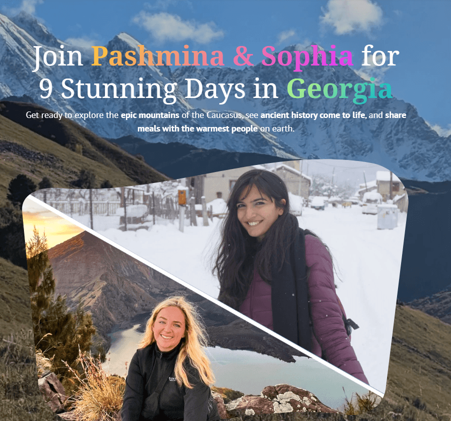
Hiking Vihren Peak: A Guide to Bulgaria’s Second-Highest Summit
/If you’ve been hearing all the buzz about Bansko being the next big nomad town and are curious to see what the fuss is about — you’re not alone.
I was too. After seeing it pop up in digital nomad circles and remote work forums, I decided to experience it for myself.
But instead of co-working spaces or visiting it during ski season, my introduction to Bansko was through a trail — yes hiking Vihren peak, the second tallest mountain Bulgaria.
If you’re spending 7 days in Bulgaria, you need to hike Vihren Peak purely because of the Pirin Mountains! They're also known as the land of giants, with more than 100 peaks surpassing 2000m in height.
Also read:
Hiking Vihren Peak: Everything You Should Know

hiking up vihren peak - vlahini lakes from the viewpoint
Peak Elevation: 2,914 metres (9,560 feet)
Starting Point: Vihren Hut (2,000 metres / ~6,560 feet)
Distance: 7.6 km round trip
Elevation Gain: 973 metres
Time Needed: 5–7 hours (round trip, depending on pace and weather)
Trail Type: Out and back
Difficulty: Hard (Not easy!)
Best Season: July to September (June can still have snow patches)
GPX files to follow: On AllTrails
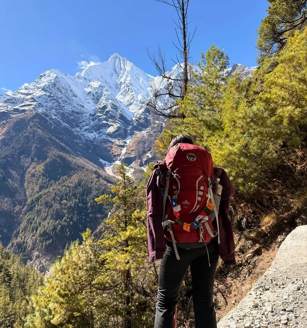
My Experience Solo Hiking Vihren Peak

enroute to vihren peak
The night before, I was frantically refreshing weather apps to see if the forecast would change.
It was September, and rain was expected in the afternoon. The skies looked gloomy, and I wasn’t sure if it was the smartest idea to hike solo.
But I decided to go ahead the next morning with one promise to myself: no pressure. If the weather turned or the trail felt unsafe, I’d turn back.
The trail starts right from Vihren Hut, a mountain refuge reachable by car or taxi from Bansko (roughly a 30–40 minute drive). I got a taxi organised by the guest house owner for about 10 euros (one way).
I left at 7am and reached about 30 minutes at the entrance of Vihren Hut. At that point, there was nobody other than two American girls who were also summitting Vihren.
I was relieved that I wasn’t the only crazy person doing this hike on my own!
Following the Red & White Trail Markers

a view of the mountains when I was on the way up to vihren peak
From the hut, you’ll follow red and white trail markers uphill. The first part of the trail meanders through rocky alpine meadows, gradually inclining.
There were some blue skies and it didn’t look too crazy weather-wise. The hut gradually looked smaller and far away as I continued hiking. It was not a hard or technical terrain but you’ll see that it can be very rocky.
I also wouldn’t entirely depend on the markers because they were not always there. Having the GPX trail is a smart idea especially if you’re hiking alone.
I also loved the seeing wildflowers and orange and yellowy hues this time of the year. I spotted some wild blueberries.
Choosing The Left Route

spot the cross sign from afar
I had read multiple blogs beforehand, and most hikers recommended taking the left fork — the safer, more gradual route to the summit.
On AllTrails, you’ll spot the fork clearly marked, and it’s easy to follow if you're paying attention.
Not long after, I passed a weathered wooden cross planted in the ground — it looked like a grave. I was wondering what’s the story behind this cross and wish there was more info but at the same time, I couldn’t stop thinking of all the 1,000 ways I could die here.
Thankfully, there are no bears or bear warning signs so it was all good!
As I headed uphill, the terrain turned more rugged, with steeper, exposed switchbacks. You’ll pass through karst limestone sections and loose stones underfoot.

There was also fog rolling in at 9.45am. It is not even 10am and I was afraid of getting lost in the fog. But out of nowhere a Russian guy told me to try and reach the peak but make sure I descend by 12pm because it would rain.
Reaching Vihren Peak

just before vihren peak summit

you can choose to continue or return if the weather is bad
The fog rolled in at 10am and by the time I reached the open grasslands before Vihren Peak it was around 10.32am.
I was completely covered in fog but in the distance I could see the gorgeous lakes. According to the sign, it is a 40 minute hike up to Vihren Peak along zig-zag lines and from there on it is the infamous Koncheta Ridge.
I decided to take a break and wait to see how the weather would unfold. The sky was shifting quickly, and I didn’t want to push forward blindly.

vlahini lakes from the viewpoint
In the distance, I spotted a few wild antelopes grazing so I wandered off briefly to get a closer look. But when I turned back, a thick fog had rolled in.
For a moment, I couldn’t even locate where I’d left my backpack. That was my cue…. to leave quickly!
Rather than risk losing my way or getting caught on the exposed Koncheto ridge in low visibility, I made the call to descend. It wasn’t worth pushing on for the summit IMHO!
What You Should You Know About The Koncheta Ridge

the exposed koncheta ridge hike
While I didn’t hike far enough to reach Koncheto Ridge on this trip, it’s worth mentioning especially if you’re an experienced hiker to consider hiking Koncheta Ridge.
Word of warning: if you’re afraid of heights, you should skip it!
I checked what does Koncheta mean and it actually is called “The Little Horse” in Bulgarian.
So this narrow limestone ridge connects Vihren to Kutelo, and it’s called that because of how hikers often straddle it like riding a horse. The ridge is incredibly narrow like only about 70 cm wide in places (yes, phew — glad I wasn’t doing this on a solo trek!)
You should know that is very steep atleast a 300–400 metre drop on either side.
There’s a metal cable fixed to the rock for support, but the exposure is no joke. I saw enough videos to know that I won’t be doing this unless I am with some company!
Even experienced hikers admit that it’s mentally challenging, especially in windy or foggy conditions. One misstep here isn’t just a sprained ankle, it’s a life-or-death situation.
If you’re planning to hike Vihren to Koncheto, make sure you’re:
Very comfortable with heights and exposure
Wearing proper footwear with good grip
Starting early and watching the weather like a hawk (look out for this website for weather conditions on YR.no)
Not hiking alone unless you’re confident in route-finding and mountain safety
On My Descent: Back to Vihren Hut

imagine my view when i saw this: wild goats on vihren peak hike

on my way down with loads of rocks and vihren chalet not too far from the distance
On my way down, the views felt different and it was all kinds of gloom for windy to foggy.
But what took my breath away was seeing these wild antelope and goat mix. They were shy creatures and it felt surreal seeing them especially when there was not a soul around me.
I took a moment to take it in and just observe them do their thing.
By 1.00pm I was at Vihren Hut sipping some hot chocolate and waiting for the 2.20pm bus. You should know what’s the bus timings to and from Vihren Hut:
Bansko to Vihren Hut: 8:30, 13:20, and 17:00
Vihren Hut to Bansko: 9:30, 14:20, and 18:00
The best thing after descending was cosying up in this cute family-owned hut that I was staying in called Grancharova Guest House. The floofy cat and conversations with the owner’s mother in law in broken Google translate Bulgarian were heartwarming.
It was a nice touch to stay with a family and feel like one of their own. I highly recommend staying here for their morning pancakes!
Also read: The Seven Rila Lakes Hike: Complete Guide to Bulgaria’s Rila Mountains
Not Keen On Doing Vihren Peak?
If the weather turns or you’re not confident to make the final push, there are so many other hikes you can do. I would recommend doing Lake Muratova hike. It takes about 90 minutes to get here from Vihren hut.
You can follow the blue/yellow route which is about 3km long.
Also read my other Balkan Posts: