Hiking the Cordillera Huayhuash Circuit Trek: Peru's Best-Kept Hiking Secret
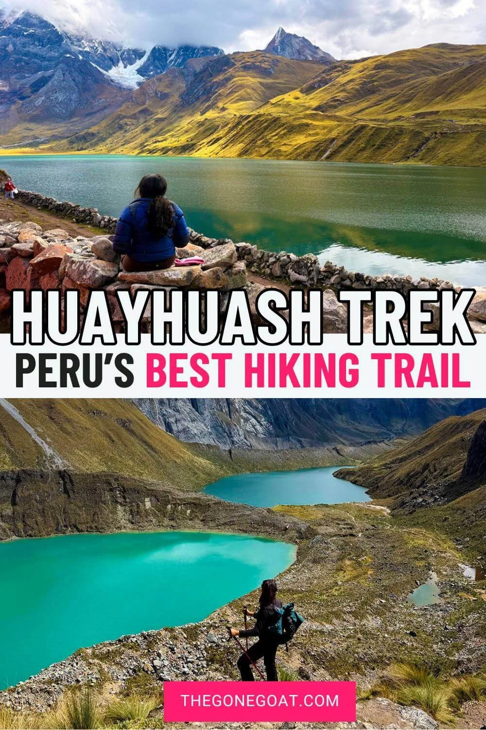
/One of the best treks in Peru is hiking the Cordillera Huayhuash Circuit Trek — pronounced as Why-Wash — and before you think oh I should do the Santa Cruz trek or treks in Machu Pichu, think again.
How often do you get to be in the remote Andes mountains and see the jagged beauty of these glacial lakes and high altitude passes?
I have done the Himalayas like the Annapurna Circuit and nothing prepares you for the raw wilderness, less crowded alternative and open alpine peaks in the Peruvian Andes mountains.
You have mountains that go up to 5,000 metres in elevation and see a different side of Peru that can’t be compared to Patagonia mountains (which is where all the hype is).
I initially signed up for 10 day trek hiking through the Cordillera Huayhuash circuit but because of altitude sickness, we ended up doing 6 days of the Huayhuash trek.
This is the entire breakdown and journey of our experience while hiking through the Cordillera Huayhuash Circuit.
Why You Should Do The Huayhuash Circuit & With Who?
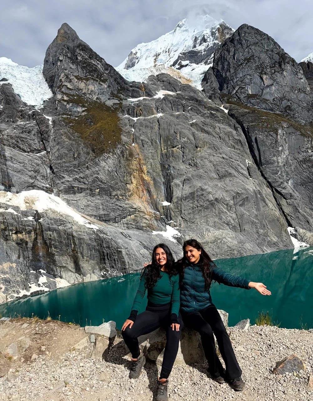
hiking the cordillera huayhuash circuit trek in peru
The Huayhuash Circuit has become popular in recent times on Instagram atleast but before this I never knew that Peru had high-altitude peaks.
Most of the terrain during the hike is between 4,000 and 5,050metres, with the highest being Santa Rosa pass which goes up to 5,050 metres.
The trail is around 130km in total covering between 10-15km per day. The hardest part is the sudden altitude gain, which is why it is crucial to spend 4-5 days in Huaraz before attempting a hike like this.
The trek was even featured in the movie and book called Touching the Void, which features the iconic peaks called Siula Grande (6,344 m). It tells the true 1985 survival story of two British Mountaineers.
I did this trek with High Expeditions and I highly recommend doing this trek with this small-group and professional operator in Huaraz. They make sure there is an oxygen tank, emergency horse, high quality tents and sleeping bags with amazing food (I had the best Peruvian food in these mountains here).
I saw people choosing other cheaper operators and it was too crowded, and they complained of bad quality tents and torn sleeping bags. So choose your trek operator wisely.
I highly recommend going with a small-group operator that knows how to gradually space out the days.
The Route
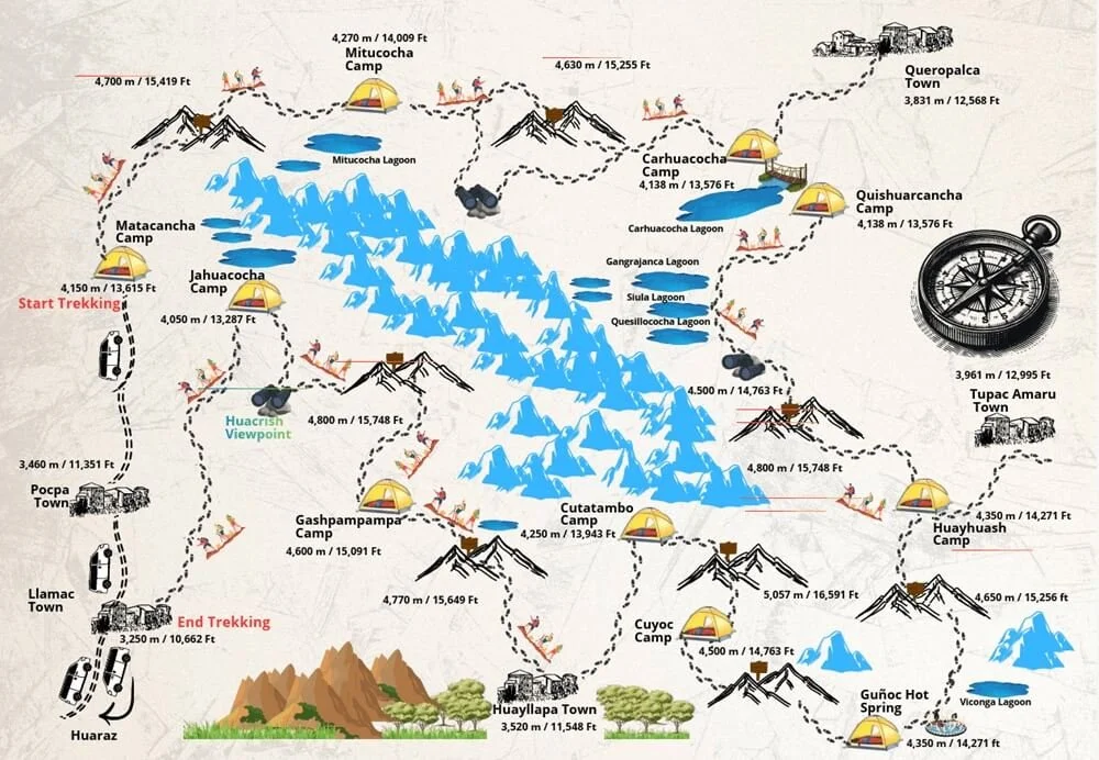
trek overview of the 10 day cordillera huayhuash circuit with high expeditions
This is an overview of the 10 day route — even if you do the shorter alternatives it would follow the same route.
The 5-6 day route we did stops just before Santa Rosa pass and the last day would be at the Gunoc Hot Springs.
The costs for the trek ranges from $899 usd (5 days), $1493 (8 days) to $1658 (10 days).
The sweet spot is the 8 days route which everyone seems to be doing. If time is not an issue for you, I would highly recommend booking it here.
The Acclimatisation Hikes
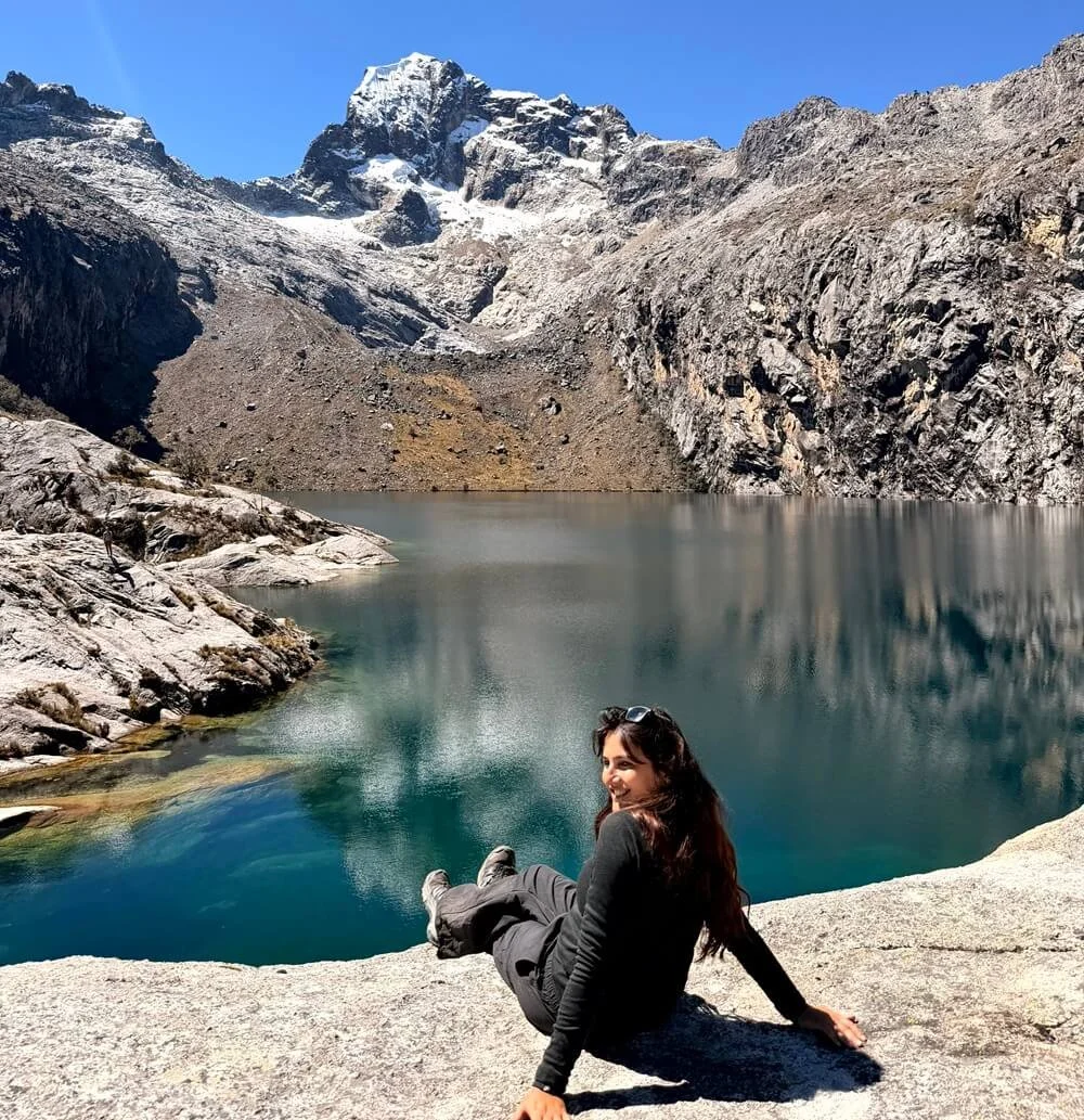
laguna churup - one of the few acclimatisation treks in peru before attempting the huayhuash circuit
To prepare for these hikes, we were given two hikes to do before attempting the Cordillera Huayhuash trek.
We flew into Huaraz early in the morning from Lima and spent the day drinking copious amounts of Coca tea which is meant to help with altitude sickness.
The next day we headed for Laguna Churup as our first acclimatisation hike — and oh boy, I got hit hard by altitude sickness. Sitting at 4,600m, this hike hit me like a trainwreck. Eventhough it is 45 minutes away from Huaraz, I absolutely recommend doing this hike on your third day in Huaraz not the second day.
My friend had no problem, but I had headaches, and felt nauseous and weak the entire way. Although I completed the trek successfully, when I was there everything felt like a blur. It was almost like I was too brainfogged to know or take in the beauty of this absolute gorgeous place.
You have to hike to Laguna Churup whatever it takes because looking back it was one of the most glorious day hikes from Huaraz. Laguna 69 is the other alternative but it takes longer to get there and it’s way more crowded.
On our third day, we hiked to Laguna Wilcacocha (which on hindsight should be your second day hike). This may seem like not such a great hike with views but we absolutely loved how chill it was, the villages we passed through and the stunning views of the Cordillera Blanca mountain range, the Callejón de Huaylas valley, and the city of Huaraz in Peru.
Hiking the Cordillera Huayhuash Circuit
Day 1: Huaraz to Mitucocha Lake (4,270m) 9km
The first day is always the hardest because you have no idea what to expect and wonder if you will do OK in such altitude.
It took a 4 hours drive from Huaraz to Matacancha, our starting point to begin our trek. The first sight of the mountains and the green and brown landscapes looked a lot like the mountains in Iceland.
The first thing we did is stopped for a proper breakfast. It felt really bougie with a proper camping chair and we had jam, eggs and a snack bag for the route.
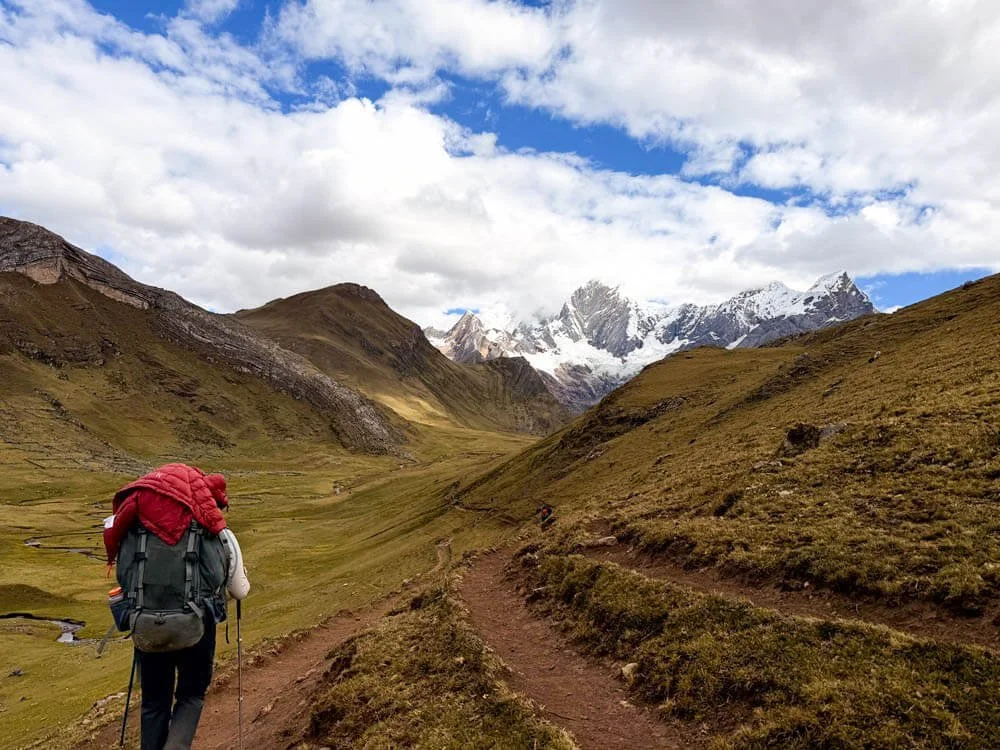
on our way to mitucocha lake on the first day of the huayhuash circuit
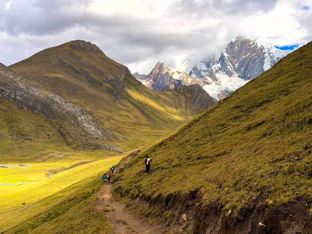
gorgeous alpine scenery
Our trek officially started as we hiked through proper alpine scenery with jaw dropping landscapes. From there, we had major views of Rondoy which reaches up to a height of 5,870 meters and Ninashanca which reaches 5,607 meters.
The highlight was Cacananpunta pass (4,700m). We bumped across a group of trekkers who were coming from the opposite side and were on a photography-only trek. It is wild to know there are all these sub-groups for hiking in the Andes mountains exist.
I will let the pictures do the talking but we finally arrived at Mitucocha Lake and camping on the first night with the views of the mountains made we want to cry. How is this real?
The campsite at Janca already has views of mountains so high that goes up to 6,000metres. We set up camp right on the shores of Laguna Mitucocha below towering Jirishanca, a 6,094-metre-high mountain in the Huayhuash mountain range.
Day 2: Carhuacocha Lake via Carhuac Pass (4,630m) 10km
We woke up to fog encroaching us but today was meant to be one of the more stunning routes as we head towards Carhuacocha Lake — the iconic route with a suspension bridge.
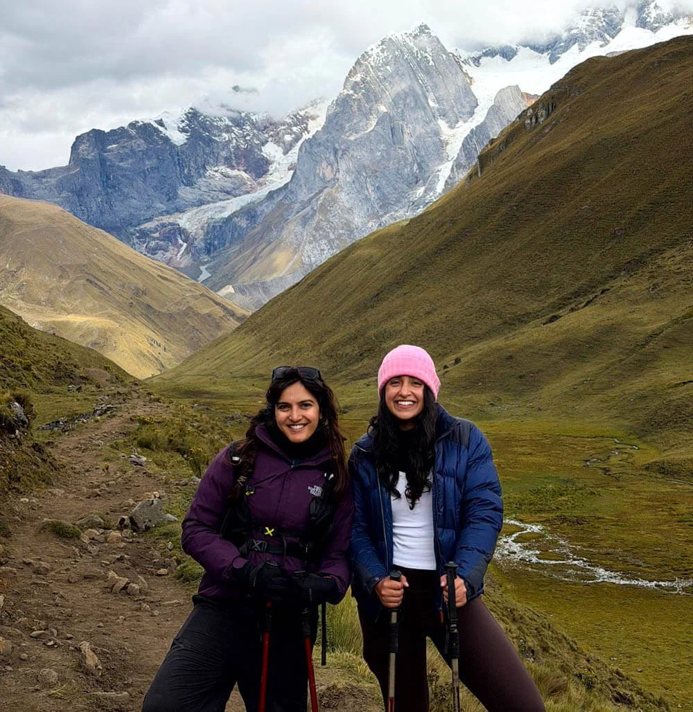
behind us are the huayhuash range - it was bitterly cold in the morning
I absolutely loved today’s views eventhough the starting bit was very cold! We followed a high alpine route across grasslands, varied paths passing through mountains in diffirent colours with towering views of glaciers right in front of us.
It is not a hard hike but it makes it impossible to not stop at every turn. The winds were gusty and it made even more special because we had fluffy dogs following us the entire route.
Eventhough it was a 6 hour hike, time flew. We reached pretty early and had so much time to enjoy Carhuacocha Lake.
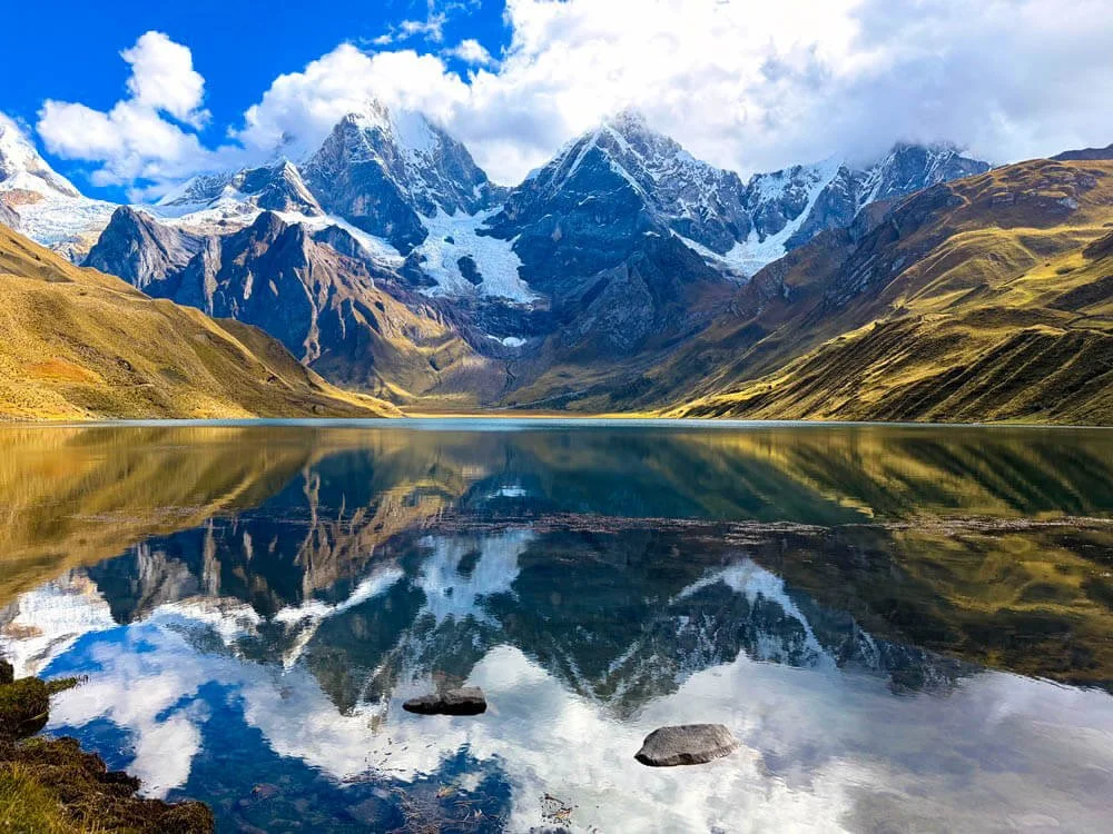
the famous Carhuacocha lake
It is so famous but the best views were during sunset and sunrise. Drinking a hot cup of coca tea and reading a book to this views was the highlight of this trek. We had views of Jirishanca (6,095 m), Yerupajá (6,635 m) and Siula Grande (6,344 m) all before us.
The mirror image against ducks swimming in the glacial water was surreal. Not forgetting, the night-time constellations. Our dinner was really special that night and loaded with protein like chicken curry and eggs!
Day 3: Trek to Huayhuash Camp via Siula Pass (4,869m) 16km
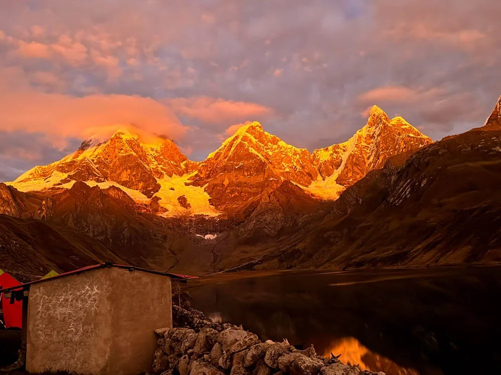
sunrise in the morning overlooking the lake
Now if you’re not a morning person, you automatically become one on this trek and especially on this day.
I am told to wake up early because sunrise of the mountains here is next level epic. The sun setting over those three mountains is the perfect reason why Huayhuash trek is stunning in every form.
It gets better on today’s hike but it is incredibly hard. This 16km is not that easy eventhough the landscapes will make you forget about all that misery.
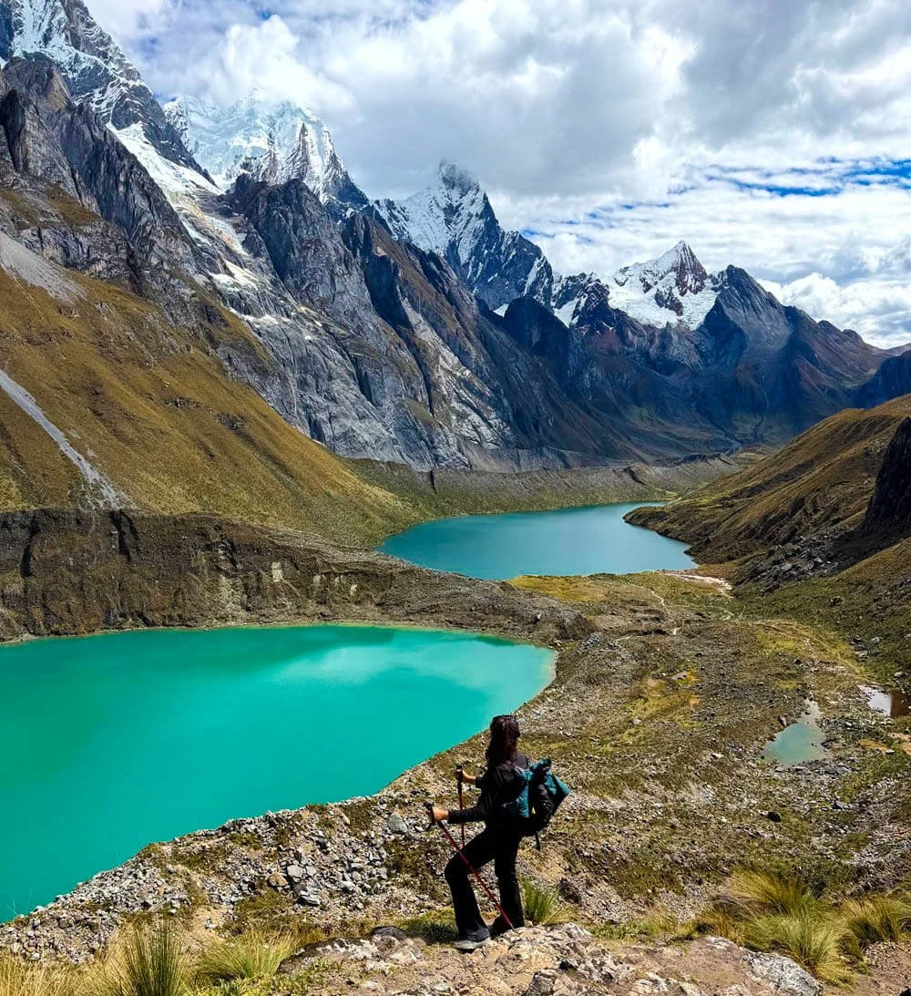
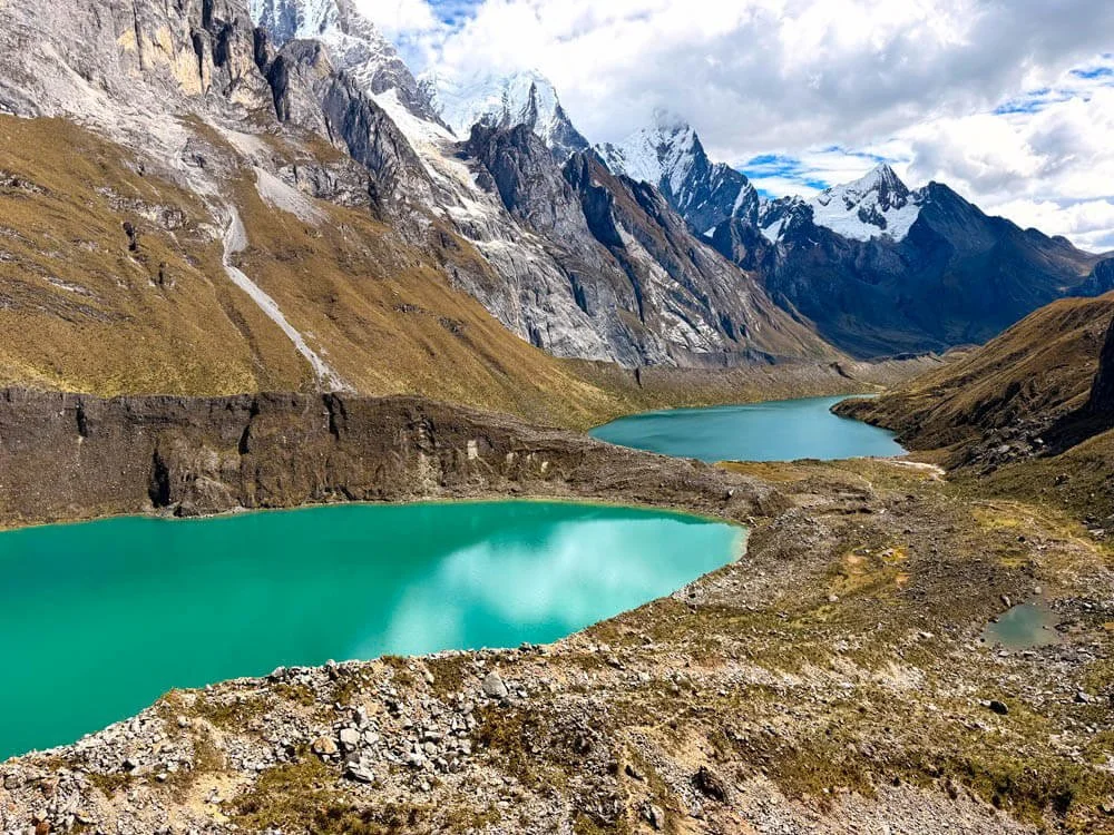
the famous Mirador Tres Lagunas - the best day on the hike and also the hardest
You will see the best of Huayhuash circuit on this hike because of the three iconic lakes. We had loose scree, grassy highlands and insanely gorgeous views. The route ascends until we see the famous Mirador Tres Lagunas and the lakes give a mirror image of Jirishanca, Yerupajá, and Siula Grande.
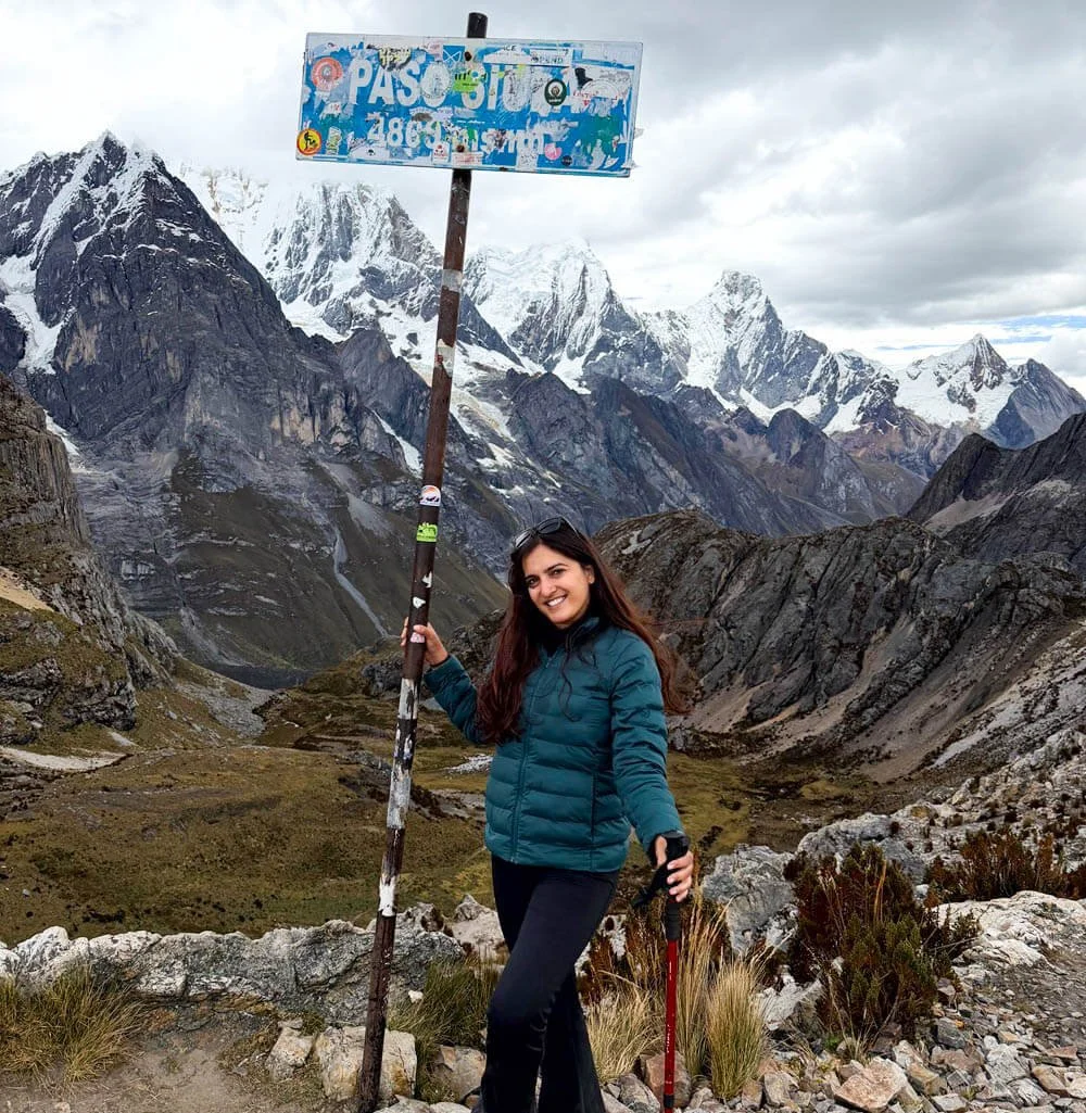
up on siula pass at 4869m
It was a green on green day because heading up to Siula Pass (4,869m) is hard and long! The altitude sapped our energy and it became so windy but somehow seeing Carnicero and Trapecio at 5,644 you can’t believe how raw and staggering each view looks.
By the time we reach Siula pass, it is cloudy but it feels incredible to be able to come this far with no illness. We stopped at the edge of the mountain for a much-needed lunch break with pasta and bread. The food has been top-notched by High Expeditions that you find that it takes a special kind of strength to be able to whip up tasty food at this elevation.
Day 4: Trek to Viconga Lake via Porchacuelo Pass (4,650m) 12km
This is one of the chillest days on the trek with very gentle inclines and gorgeous views of blue lakes with incredible views of the snowcapped Trapecio, Puscanturpa (5,430m).
The morning we woke up there was a hailstorm the night before which also meant that our cooking gas was frozen. We had granola porridge for the first morning as there was nothing or something warm since everything was frozen.
A sign of what you can’t predict in the mountains, afterall it is Winter here.
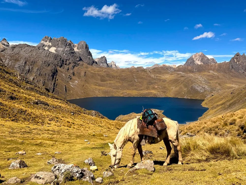
a view of viconga lake
We slowly ascended through Porchacuela pass and it was not intense but any sight of uphill was enough to make us exhausted especially since the last few days were tiring.
We could see Viconga lake in the distance and stopping here for a snack was one of the best things you could do. If you’re in no rush or a fast hiker, you could even take a nap which is what I saw some people do.
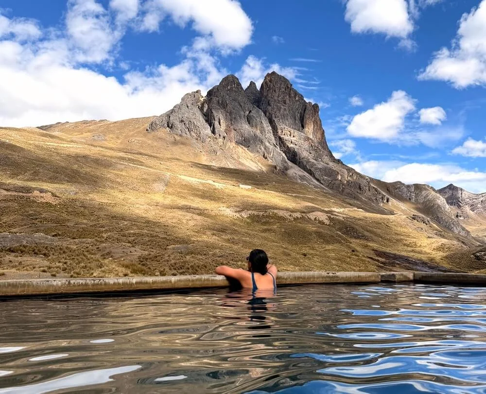
hot springs on the huayhuash circuit trek
But knowing that we have a hot spring day at the end was enough for us to speedhike. It was the perfect reward for tired legs and we finally could take a bath in these hot springs. There were 3 pools with one of them being lukewarm. Taking a dip just after lunch was the right decision before it got too windy.
Day 5: Cuyoc Pampa Camp via Punta Cuyoc Pass (5,020m) 9km
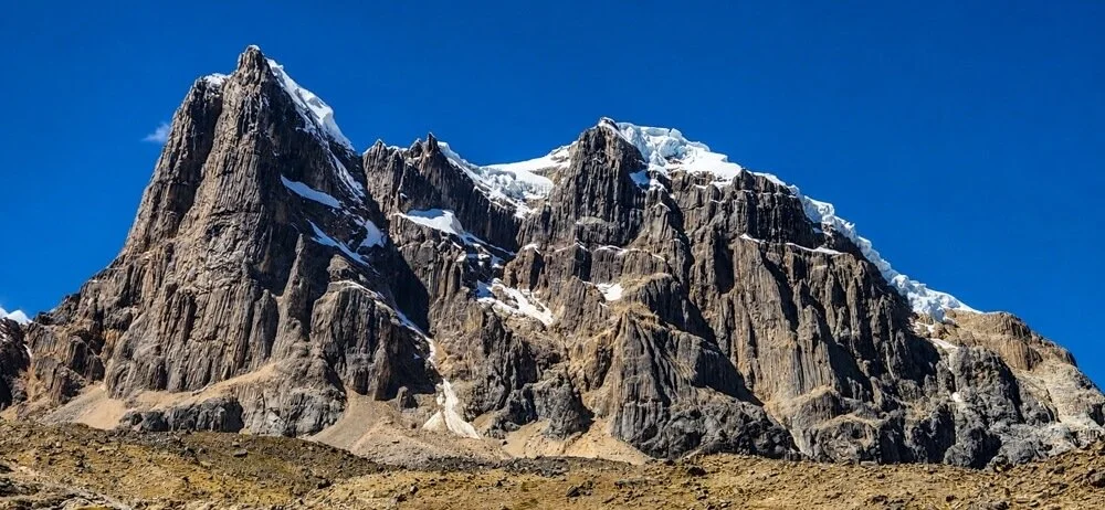
going up via punta cuyoc
Now, we didn’t get to do this day as one of us was not feeling too good. But if you continue, you will reach one of the highest pass of the Huayhuash Trek over Punto Cuyoc (5,020 m).
There are steep scree-laden slopes starts after this day but again you are reminded of how moon-like these terrain look.
It is like a desert with receding glaciers due to climate change but it is still crazy how stunningly desolate the valley looks.
Day 6: Cutatambo camp via Santa Rosa Pass (5,057m) 10km
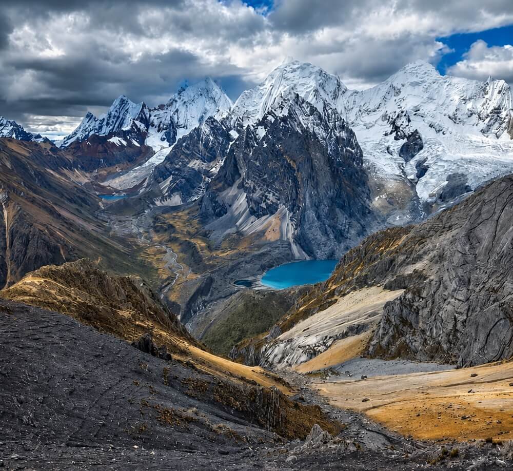
a look at santa rosa pass (pic credit: high expeditions)
This is the most toughest day out of the lot because you are essentially climbing scree-laden slopes that opens up with a valley of the Huayhuash range.
Almost everyone goes to San Antonio pass but Santa Rosa pass is the one with the most spectacular views.
The best part is seeing the grandest of all the peaks which includes the whole rang like Yerupajá, Siula Grande, Sarapo, Rasac and Jurau. It is not just the mountains, but tiny lake at the bottom makes everything look so vast and unimaginable.
From there, you descend towards the Calinca valley, where the Cutatambo camp is located at (4,250m). Apparently, this is the last refuge of the legendary Joe Simpson before he conquered Siula Grande.
The rest of the itinerary if you do decide to do 8 days or 10 days follows a heady mix of mountains. Read on to see what I mean.
What happens if you keep going
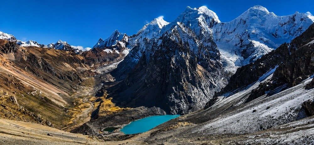
santa rosa pass
We turned around at Cutatambo, so I'm not going to pretend I walked the full loop. But this is what the standard 8 and 10 day itineraries look like from there, and it's worth knowing before you book, because most people book the short version and then spend the whole trek hearing about the part they're missing.
From Cutatambo you drop down the Calinca valley to Huayllapa, the only actual village on the circuit. This is the one place you can buy a cold drink. Then it climbs again, hard, over Tapush Pass (4,770m) and Yaucha Pass (4,850m), and this is where people get quiet. This is the part where it feels never-ending
The payoff is ofcourse at the end at Jahuacocha. Everyone who has done the full loop talks about Jahuacocha. It sits at 4,050m under Yerupajá and Rasac, and it's the campsite people extend an extra day for. Then you walk out over Pampa Llamac to Llamac and a bus back to Huaraz.
So: if you're picking between 6, 8 and 10 days, the honest answer is that days 1 to 4 give you the iconic photos, and the last stretch gives you Jahuacocha and ofcourse if you do 6 days you can choose to include Santa Rosa pass or stop at the hot springs.
Guided or Self-Guided for the Huayhuash Trek
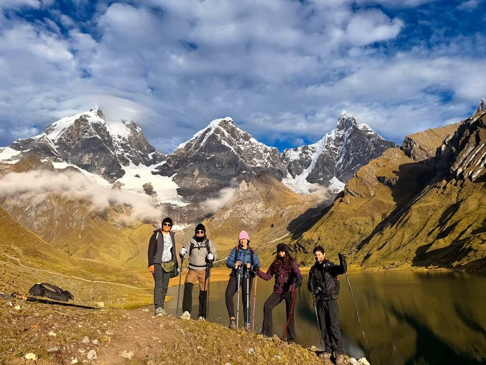
our small group from different countries on the huayhuash trek
You can do this unsupported. People do. You'll be carrying six to ten days of food and a tent over multiple 4,800m passes but I overheard conversations from few people who were so tired by day 2 because they didn’t factor in the altitude.
It wore them down and if I were you, I would definitely do it guided.
Most people go guided, and I'd say for a first Andes trek that's the right call. We went with High Expeditions and the food was genuinely absurd for the elevation. The fact that you can get amazing Peruvian food at this elevation is also part of the experience.
When To Go?
June to August is the safest window,
Also, dry season does not mean bad weather. We got a hailstorm that froze the cooking gas overnight and ate cold granola porridge for breakfast. It's winter in the mountains. You should be prepared for hail, wind and sun in the same afternoon.
Acclimatisation, and the mistake I made
I've already said it in the Laguna Churup section but I'll say it again because it's the single most useful thing in this post.
Do not do Churup on your second day in Huaraz. Do Wilcacocha on day two and Churup on day three. Wilcacocha is gentle, tops out lower, passes through villages and gives you the whole Cordillera Blanca panorama. It's the perfect warm up.
Three days minimum in Huaraz before the trek. Four is better. Drink the coca tea, walk slowly, and if you're considering Diamox, take half a pill 2 days before.
Fitness, honestly
This is not a technical trek and very doable. There's no scrambling, no ropes, no exposure that would scare a confident hiker. You're crossing a high pass most days, you're sleeping above 4,000m every night, and the altitude takes maybe 30 to 40 percent off whatever you think your capacity is.
If you can do a 15km day hike with 800m of ascent and feel fine the next morning, you can do this.
The hardest days are Siula Pass (16km) and Santa Rosa (loose scree, long climb). Everything else is manageable.
Cordillera Huayhuash FAQ
here’s everything you need to know about the huayhuash trek
How hard is the Huayhuash trek?
Hard but not technical. No climbing skill required. The difficulty comes from doing 9 to 16km days with a 4,600m to 5,000m pass most days, while sleeping above 4,000m the entire time. If you're a regular hiker who trains, you'll manage.
How many days do you need? The classic full circuit is 10 days. There are 8 day versions that cut a section, and shorter 4 to 6 day options that do the northern and eastern side, which is where the famous lakes are. We did 5-6days. If you only have a week, the shorter version still gets you Mirador Tres Lagunas and Carhuacocha, which are the two views everyone comes for.
What's the maximum altitude?
The highest passes on the full circuit are Punta Cuyoc at 5,020m and Santa Rosa at 5,057m. Campsites sit between roughly 4,050m and 4,700m.
Do I need a guide?
I highly recommend getting one and booking with the recommended agency here: High Expeditions. Unsupported means carrying a week of food over 5,000m passes. Guided means mules carry the load and someone cooks.
When is the best time to go?
May to September. June to August is driest and most reliable. Expect hail, wind and strong sun regardless.
How do I get to the trailhead?
Fly or bus to Huaraz from Lima, spend three to four days acclimatising, then it's roughly a four hour drive to Matacancha.
Which acclimatisation hikes should I do?
Laguna Wilcacocha on day two, Laguna Churup on day three. Laguna 69 is the famous alternative to Churup but it's further and much more crowded.
Will I get altitude sickness?
Possibly. I did. Headache, nausea, weakness, the works, and I still finished. Acclimatise properly, ascend slowly, drink far more water than feels necessary, and talk to a doctor about medication before you travel. If symptoms get worse, get on a horse and go down.
Is it crowded?
No. It's one of the great multi-day treks in the world and you'll go hours without seeing anyone. Compared to the Inca Trail or Salkantay it's practically empty but it is getting more popular these days though.
What's the food like?
On a guided trek, we had the best food ever. We had chicken curry, eggs, fresh bread, hot soup, a snack bag, pasta, and a lot of dry fruits. We were always well-fed!
Are there toilets and showers?
There is an actual flushing toilet, believe it or not. The campsites were very clean. No showers ofcourse, you just do your own mini wet-wipe shower. The one exception is Viconga, where there are natural hot springs with three pools.
Can I charge my phone?
No. Bring a power bank sized for the full trek. I bought two power banks and one equipped with solar panels. I kept my phone on airplane mode. You could charge your phone on Day 4 at the hot springs spot but they charge quite a bit like 30 soles per hour or so.
Is there phone signal?
Nope. Bring a book and enjoy no wifi or signal.
Would you do this trek? Feel free to comment below if you have any questions.
Like this story? PIN IT!